GEOGRAPHIC INFORMATION SYSTEM (GIS):
BTC develops and provides digitization representation data bases for accurate and color-correct information. Reliable information is provided to allow the transfer of information and assist in the understanding of environmental impacts related to land use and proposed actions. The electronic management system (eTMS) can be an important component for the management of information and can be adapted to provide information to using agencies and managers.
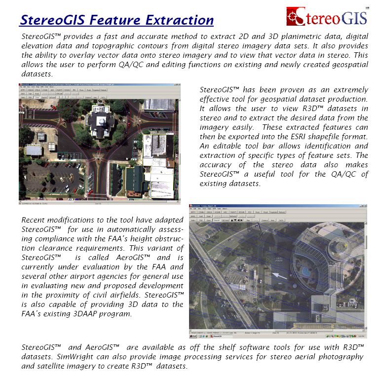
BTC-GIS SimWright Tools
BROADBAND TECHNOLOGY CORP-GIS SIMWRIGHT TOOLS